

Cape Town is one of the world’s great hiking destinations, and Table Mountain sits right at the heart of it. With dozens of routes leading to its summit, ranging from easy walks to technical scrambles, Table Mountain alone offers enough variety to fill several trips. Beyond the mountain itself, the wider Cape Peninsula adds even more, from short, sharp viewpoints and shaded forest trails to hidden waterfalls, open fynbos, and long stretches of coastal beach.
What makes hiking in Cape Town so special is just how much variety sits within a short drive of the city. In a single day, it is entirely possible to hike through indigenous forest, along an exposed mountain ridge, and finish with a walk along the beach, each offering a completely different experience of the same small stretch of coastline. Whether you have a single morning free or a full week to explore, here are some of the best trails Cape Town has to offer.
Table Mountain
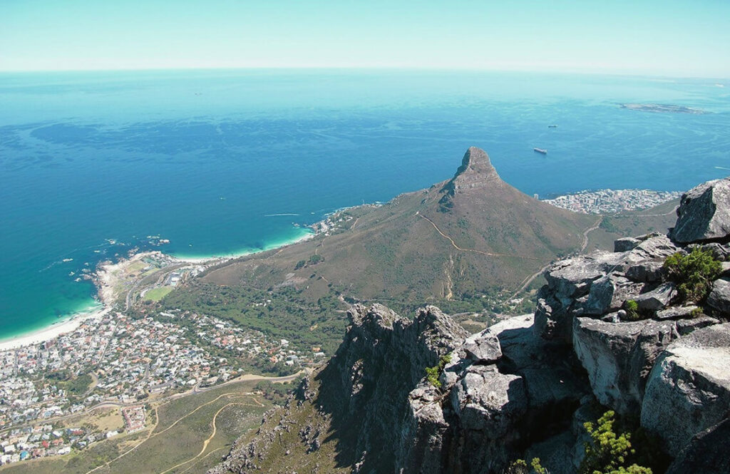

No guide to hiking in Cape Town is complete without Table Mountain itself. Rising 1,086 meters above the city, it offers one of the widest ranges of hiking terrain found anywhere on the peninsula, from the level, easy going Pipe Track to the technical scrambling of India Venster. Routes vary enormously in length, difficulty, and scenery, taking in everything from shaded indigenous forest on the eastern slopes to exposed sandstone cliffs and panoramic Atlantic views on the western side. Whether you are after a short, accessible walk or a full day summit route involving real elevation gain and exposure, there is a Table Mountain hike to match.
Lion’s Head
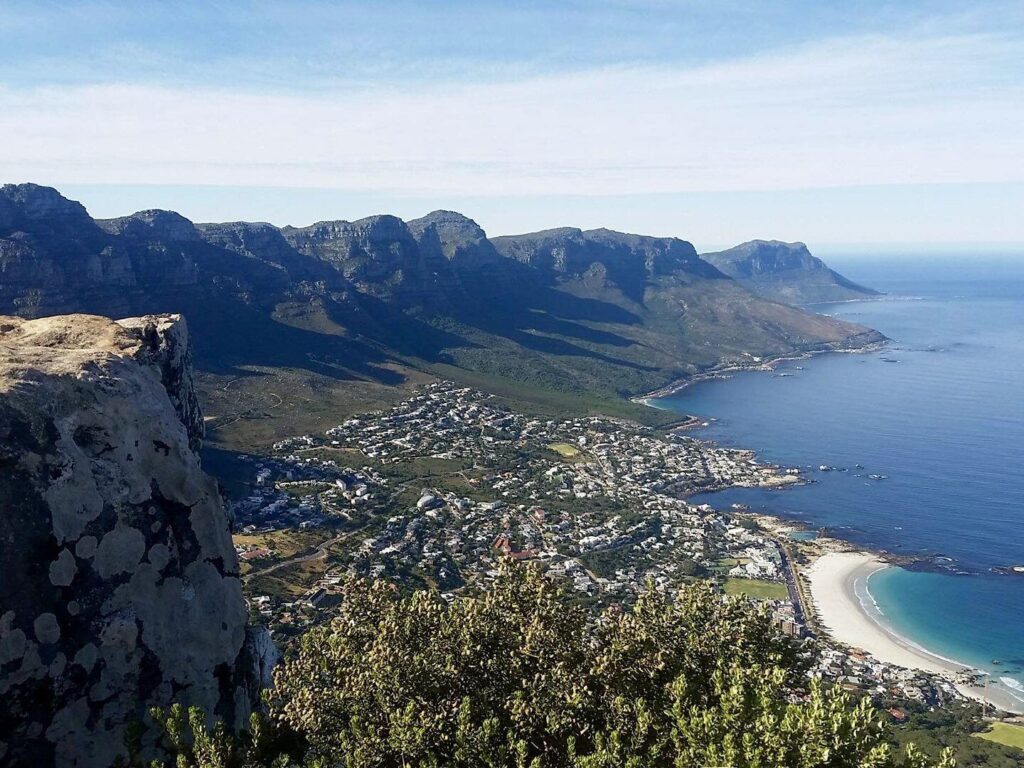
Lion’s Head is one of Cape Town’s most iconic hikes, spiraling around the mountain to a summit of 669 meters above sea level, with uninterrupted 360 degree views throughout. Staples, chains, and ladders assist hikers over a short, steeper section near the top, which can be bypassed for those less comfortable with exposure. It is especially popular as a sunrise hike, and on full moon nights, when hikers gather at the summit to watch the moon rise over the city. Read our full guide to hiking Lion’s Head.
Kloof Corner
For a short, high reward hike, Kloof Corner is hard to beat. Starting from Tafelberg Road, this steep but brief climb takes around 20 to 30 minutes and rewards hikers with sweeping views over Lion’s Head, Camps Bay, and the city below. From Kloof Corner, the trail connects onto the Table Mountain Contour Path, a flat path that can be followed for as long as you like, extending all the way to Platteklip Gorge and beyond towards Newlands Forest. It is a favorite spot for sunset, and one of the easiest ways to get a taste of Table Mountain’s scenery without committing to a full summit hike.
Devil’s Peak
Rising to the east of Table Mountain, Devil’s Peak offers some of the best panoramic views of the city and Table Bay. Several routes lead to the summit, with the Tafelberg Road route best suited to beginners, while the Newlands Ravine route, a 3.9 km trail shaded by beautiful indigenous forest, offers a more challenging ascent for experienced hikers. The Mowbray Ridge route, a 5 km trail via Rhodes Memorial and King’s Blockhouse, traverses a section known as the Knife Edge, and is a popular alternative for hikers looking for a more technical climb. This area has occasionally seen isolated incidents, so hiking in a group and leaving valuables behind is a sensible precaution.
Newlands Forest
For hikers wanting a break from exposed rock and open sky, Newlands Forest offers a completely different experience, shaded indigenous forest trails winding beneath tall pine and yellowwood trees, with several well marked loops suited to casual hikers, families, and trail runners alike. The forest connects through to the Table Mountain Contour Path and onward towards Kirstenbosch and Cecilia Forest, making it easy to combine into a longer route. It is one of the most accessible, low key hiking spots close to the city, and a good example of just how varied Cape Town’s hiking really is within a short distance of the CBD.
Cecilia Forest Waterfall
Tucked into the forested slopes just south of Kirstenbosch, Cecilia Forest offers a beautiful, family friendly hike to a hidden waterfall. The 4.3 km loop takes around two hours, winding through shaded forest and mountain fynbos before reaching the falls, at their most spectacular after rain, tumbling over bright green ferns and moss. Dogs are welcome, and are permitted off leash in designated areas of the forest, making it a popular choice for local hikers with pets. It is one of the more accessible waterfall hikes near the city, and a peaceful contrast to the more exposed, rocky terrain found on Table Mountain itself.
Chapman’s Peak

Rising above Chapman’s Peak Drive, one of the most scenic coastal roads in the world, this summit hike climbs steadily through proteas and fynbos, with a short scramble near the top. The round trip covers around 5 to 6 km and takes roughly two to three hours, passing a plateau between Noordhoek Peak and Chapman’s Peak before the final ascent. From the summit, views stretch north to Hout Bay, south to Noordhoek Beach and the Noordhoek Amphitheatre, and east across Silvermine, with Table Mountain visible on clear days. Late afternoon is a particularly popular time to hike, when the sandstone cliffs glow warm in the setting sun. Note that the trailhead sits along the tolled section of Chapman’s Peak Drive, so a day pass or toll fee applies.
Silvermine and Elephant’s Eye Cave
Further south, Silvermine Nature Reserve offers a different landscape entirely, open fynbos, a scenic dam, and the Elephant’s Eye Cave, a large, moss covered cave reached via a roughly 5 km round trip, offering sweeping views over the Constantia Winelands. A longer option, the Panorama Loop, covers around 7 km from the Silvermine Dam and climbs steadily along a wide gravel track, with views extending from Muizenberg and Fish Hoek to Simon’s Town and the white sands of Noordhoek and Kommetjie. The reserve’s trails are generally accessible and well suited to families or those wanting a lower intensity hike with a rewarding destination.
Kalk Bay Mountains
Along the False Bay coastline, the Kalk Bay mountains offer trails rich in fynbos and expansive sea views. A popular route climbs from Kalk Bay through Echo Valley to the Amphitheatre, a natural, low lying, sandy bowl surrounded by rocky outcrops, a peaceful spot to rest partway through the hike. From here, trails continue either towards Fish Hoek and Cape Point along the undulating coastline, or through the shaded, fern filled Spes Bona forest towards St James. The terrain here is generally more accessible than the steep front face of Table Mountain, making it a lovely, lesser known alternative for hikers who want big views without the crowds.
Cape Point Nature Reserve
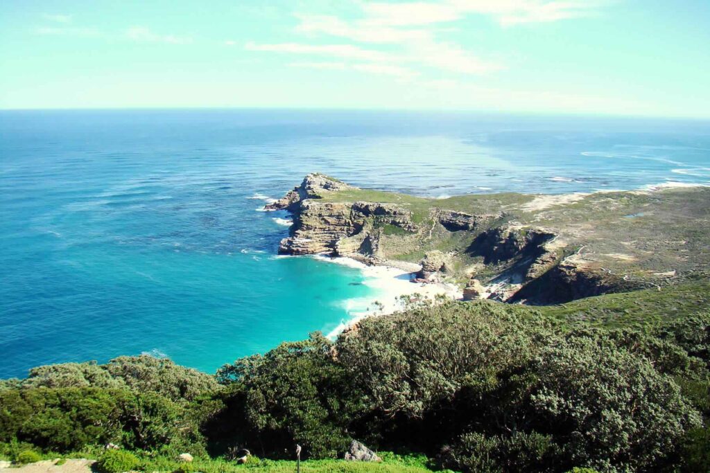
At the very tip of the Cape Peninsula, the Cape Point Nature Reserve offers a completely different kind of hiking experience, rugged coastal fynbos, dramatic cliffs, and roaming wildlife including zebra, eland, and ostrich. The Cape of Good Hope Trail, a well maintained 3.5 km boardwalk, leads to the famous Cape of Good Hope sign at the most southwesterly point of the African continent, with views over Diaz Beach along the way. Several other trails in the reserve pass historic shipwreck sites, including the Thomas T Tucker wreck near Olifantsbos on the reserve’s western coast, a popular, family friendly route.
Noordhoek to Kommetjie Beach Hike
For something completely different, the beach hike between Noordhoek and Kommetjie follows roughly 8 km of open sand beneath the shadow of Chapman’s Peak. Along the way, hikers pass the rusted remains of the Kakapo, a steamship that ran aground here in 1900 after its captain mistook Chapman’s Peak for Cape Point in poor visibility, as well as tidal lagoons, birdlife, and the surf break at Bokramspoint. The walk takes around two to four hours depending on pace and offers sweeping views of Hout Bay and Chapman’s Peak throughout, though as with any quieter, more remote stretch, it is best walked with others rather than alone.
Best Time to Hike in Cape Town
Cape Town’s hiking season runs year round, though conditions vary considerably. Summer (December to February) brings warm, dry weather but also strong winds and intense UV exposure, particularly on exposed routes like Table Mountain and Lion’s Head. Autumn (March to May) is widely regarded as the best time to hike, with calmer winds, fewer crowds, and pleasant temperatures. Winter (June to August) brings rain and a greater chance of mist, though forest trails like Newlands and Cecilia Forest are particularly beautiful during this period, when waterfalls are at their fullest. Spring (September to November) offers mild weather and the added bonus of fynbos in bloom across many of the region’s trails.
Cape Town Hiking Checklist
Wherever you choose to hike, a few basics apply across every trail in and around Cape Town:
- Check the weather forecast before setting out
- Choose a route suited to your fitness level and experience
- Tell someone your planned route and expected return time
- Carry enough water and sun protection, particularly on exposed routes
- Wear proper hiking shoes or boots
- Hike with others rather than alone, particularly on quieter or more remote trails
- Start early to avoid the midday heat and afternoon crowds
- Check whether a permit is required, some reserves, including Table Mountain National Park, require a My Activity Permit for certain trails or activities
Planning Your Cape Town Hike
With so much choice, the right hike often comes down to how much time you have, your fitness level, and what kind of scenery you are after. Table Mountain remains the obvious starting point for most visitors, offering the greatest variety of routes and views in a single destination, but the trails beyond it are well worth exploring for anyone spending more time in the city.
If you are planning a Table Mountain hike, our experienced guides can help you find the right route for your fitness level and interests. Browse our guided Table Mountain hikes or get in touch to start planning your Cape Town adventure.


